In This Article
There's no official "4 Corners" ride in PEI — so I made one. This custom route hits four lighthouse checkpoints at the corners of the island, sticks to the best coastal roads, and keeps the total distance under 500 km so you're not completely wrecked by the time you roll back into Charlottetown.
Unlike rides that chase raw distance or try to tag some obscure endpoint in a potato field, this route is built around actually enjoying Prince Edward Island. Red sand cliffs, ocean views for most of the day, good food stops, and roads that touring motorcycles were made for.
I designed it to be completable in one day starting from Charlottetown or the Confederation Bridge. It's a challenge ride you can actually finish and feel good about, not a survival test.
PEI Coastal 4 Corners Motorcycle Ride — The Ultimate One-Day Touring Route
The Four Corners
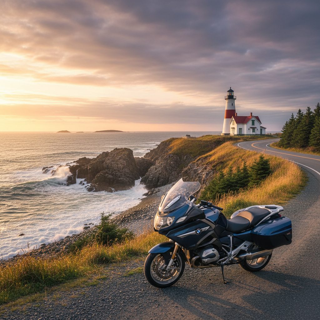
West Point Lighthouse
One of the most iconic lighthouses on the island and a perfect western checkpoint. The roads coming in from Route 14 are smooth, fast, and scenic — exactly what you want first thing in the morning when the legs are fresh.
- Incredible ocean views and red cliff scenery
- Great motorcycle photo opportunities
- Quiet coastal roads with almost no traffic early morning
Route 14 · Route 12 coastal sections
Bonus stops: Cedar Dunes Provincial Park · Wind turbine viewpoints near O'Leary
Covehead / North Shore
Instead of grinding all the way to North Cape (which would blow the distance budget), this route uses PEI's famous North Shore as the northern checkpoint. Better roads, better views, and a lunch stop that's worth the detour.
- Flowing coastal roads with ocean on your left most of the way
- Red sand cliffs and the best scenery on the island
- PEI National Park viewpoints accessible right from the road
Route 6 · North Shore coastal roads
Food stop: Richard's Fresh Seafood, Covehead — do not skip this · Bonus: North Rustico, Cavendish coastline
East Point Lighthouse
Eastern PEI is criminally underrated for motorcycle riding. The roads through Souris, Basin Head, and Elmira are peaceful, rolling, and almost entirely free of tourist traffic. East Point itself is the easternmost tip of the island — a genuinely cool checkpoint.
- Easternmost point of Prince Edward Island
- Rolling curves through fishing villages
- Basin Head "Singing Sands" beach nearby — worth a quick stop
Route 16 · Souris coastal route
Bonus stop: Basin Head Provincial Park
Point Prim Lighthouse
The perfect way to finish the day. The roads into Point Prim are some of the best on the island — winding, quiet, and absolutely beautiful in late afternoon light. If you time it right, you'll hit this checkpoint right around sunset.
- Winding coastal roads that feel purpose-built for touring bikes
- Quiet countryside — almost no other traffic by late afternoon
- Stunning ocean views and a great sunset destination
Route 209 · Shore roads south of Charlottetown
Food stop: Point Prim Chowder House — earn your chowder
The Route
Start in Charlottetown or at the Confederation Bridge. The loop runs west first, then north along the shore, then east to the tip, then south for the final checkpoint before returning to Charlottetown.
Charlottetown → West Point → Covehead/North Shore → East Point → Point Prim → Charlottetown
This direction minimizes backtracking, keeps better light on the north shore during midday, and puts the best sunset scenery at the end of the day.
Distance Breakdown
| Leg | Distance |
|---|---|
| Charlottetown → West Point Lighthouse | ~125 km |
| West Point → Covehead / North Shore | ~105 km |
| Covehead → East Point Lighthouse | ~125 km |
| East Point → Point Prim Lighthouse | ~95 km |
| Point Prim → Charlottetown | ~45 km |
| Total (estimated) | 430–490 km |
The variance comes from side roads and scenic detours. Stick to the main route and you're closer to 430 km. Go exploring and you'll push toward 490. Either way, it's very doable in a day.
Suggested Schedule
Best Roads on the Route
Route 14
Excellent western coastal riding — smooth pavement, flowing curves, almost no traffic.
Route 6
The classic PEI North Shore road. Ocean views, rolling terrain, and the best stretch of the whole island for photography.
Route 16
One of the most underrated motorcycle roads in Atlantic Canada. Eastern PEI is a hidden gem.
Route 209
Winding coastal road into Point Prim. Feels like it was designed specifically for touring bikes.
Recommended Food Stops
Richard's Fresh Seafood
Covehead — North Shore lunch stop. Local favourite. Don't skip it.
Point Prim Chowder House
Point Prim — You've earned the chowder by this point.
Bogside Brewing
Montague — Great stop on the eastern leg if you need a break.
The Lobster Barn
Victoria-by-the-Sea — Worth a detour on the southern leg.
Ride Rules (Optional Challenge)
- Photo of your motorcycle at each of the four lighthouse checkpoints
- Collect a receipt or timestamped photo at each corner to prove the route
- Track the full route using REVER, Harley Ride Planner, or your preferred GPS app
- Complete the entire ride in one day
- Avoid Trans-Canada sections whenever possible — stick to the coastal roads
Why This Route Works
Most "challenge" rides prioritize distance over experience. This one is built the other way around — under 500 km, four genuine landmark checkpoints, the best roads on the island, and actual good food stops built into the schedule.
It's less exhausting, more scenic, and easier on touring bikes like an Indian Pursuit. You'll finish the day actually wanting to come back and do it again — not swearing off long rides for a week.
If you do the ride, tag me — I'd love to see how your day went.